
Flight data posted online appears to show another Army helicopter flying higher than the maximum altitude allowed around Ronald Reagan Washington National Airport in Washington, D.C., before last week’s fatal collision between a Black Hawk helicopter and a passenger plane.
The military aircraft flew around the airport twice on Jan. 18, never dropping below an altitude of 300 feet, according to data posted on FlightAware.com. That would place it 100 feet over the area’s 200-foot maximum limit, which President Donald Trump has accused the Black Hawk helicopter of similarly violating, potentially resulting in the Jan. 29 crash that killed 67 people.
But just like in last week’s catastrophe, the data from Jan. 18 helicopter ― which used the same call sign, PAT25, as the one in the Jan. 29 crash ― likely doesn’t show the entire picture accurately. And it underscores the need to wait before casting judgment, according to Dr. Michael McCormick, a former vice president at the Federal Aviation Administration’s Air Traffic Organization and current assistant professor of air traffic management at Embry-Riddle Aeronautical University.
“The altitudes that you see displayed here may not be accurate,” McCormick told HuffPost on Wednesday of the readings that are received by Air Traffic Control and publicly shared by sites like FlightAware. “The only way we are going to know for certain is when they review the flight data recorders from onboard both aircraft.”
The reason is that the flight data displayed in Air Traffic Control recordings, known as MODE C or MODE S altitude data, “only needs to be accurate within 300 feet,” he said.
“As long as the altitude that’s being displayed on the controller’s radar display is similar, between 300 and 900, that’s good,” McCormick said. “An aircraft showing 300 feet on tower radar display, even if the aircraft is actually flying at 200 feet, is not considered erroneous.”
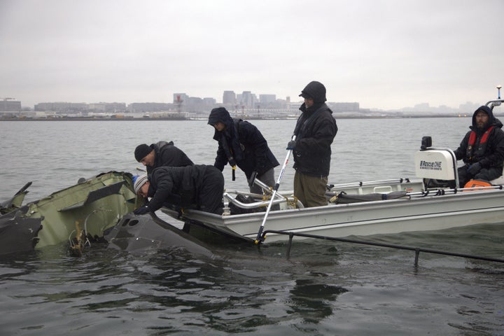
The National Transportation Safety Board, which is overseeing the crash investigation, has similarly emphasized that the altitude data observed by the control tower is not always accurate. At a press conference Saturday, NTSB officials described the discrepancies between the data from the control tower and the data from the plane’s flight recorder on the night of the crash.
Though the helicopter was seen by the control tower traveling at 200 feet when it struck the passenger plane, officials say the data from the plane’s flight recorder shows that the plane was at an altitude of 325 feet (plus or minus 25 feet) when the collision occurred.
Brice Banning, NTSB investigator in charge, stressed that the radar data showing the helicopter’s altitude “has less fidelity.”
“I think that it’s important to note that this is a complex investigation. There’s a lot of pieces here,” he said.
NTSB member Todd Inman similarly said that until the flight data recorders from both aircrafts are analyzed, the helicopter’s altitude is unknown and can’t be speculated.
Go Ad-Free — And Protect The Free Press
Already contributed? Log in to hide these messages.
“Obviously an impact occurred, and I would say that when an impact occurs, that is typically where the altitude of both aircraft were at the moment,” he said. “But again, when we have the data from the recorder we will be able to give you more specific [information].”
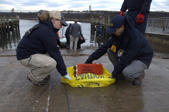
The NTSB recovered this recorder late last week, though they have said it will take time to retrieve its data, as it became waterlogged in the Potomac River. The recorder also didn’t have time stamps, which investigators will have to manually create, according to the NTSB, requiring additional time to validate.