A mix of snow and rain is expected for Metro Vancouver, while a snowfall warning is in effect for the Sea to Sky Highway.
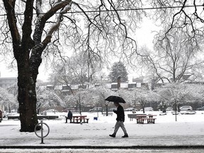
Residents of B.C.’s South Coast are being asked to make sure they have winter tires and warm clothes, as the region prepares for a blast of wintry weather starting Thursday.
Recommended Videos
Environment and Climate Change Canada has posted a special weather statement, saying a wintry mix of weather is expected to impact Vancouver Island and Metro Vancouver for the next several days.
A low pressure system is expected to move over Metro Vancouver Thursday afternoon, with rain in most areas or wet snow over higher elevations.
Some parts of the region could see up to four centimetres of snow by Friday morning before the snowfall turns to rain, according to the alert.
On Friday, temperatures are expected to rise and most areas will see just rain throughout the day. Some regions such as the North Shore could see significant rainfall amounts, the federal weather agency said.
Then, on the weekend, temperatures will likely fall again as cold Arctic air moves in and mixes with the Pacific moisture.
“Amounts are uncertain at this time but accumulating snow is likely in many areas this weekend,” the alert said. There’s a chance of rain or snowflurries on Saturday and Sunday, and then periods of snow forecast for Monday.
Meantime, a snowfall warning has been issued for the Sea to Sky Highway, with up to 20 centimetres of snow expected by Friday.
The agency warns that weather in the mountains can change suddenly resulting in hazardous driving conditions. Drivers are being reminded to use winter tires and chains if necessary.
A special weather statement for a mix of winter weather has also been posted for the Sea to Sky Region from Squamish to Whistler.
The agency says by early next week very cold and dry air is expected over the South Coast with outflow conditions from an Arctic ridge of high pressure settling over the region.